+94 11 22 55 784
 srilankajagathtours
 info@srilankajagathtours.com
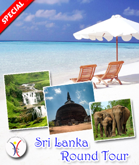
6 Nights / 7 Days
 Day 01 - Airport to
Habarana
Day 02 - Habarana
Day 03 - Habarana to
Kandy
Day 04 - Kandy
Day 05 - Kandy to Nuwara
Eliya
Day 06 - Nuwara Eliya to
Bentota
Day 07 - Bentota to Airport
Day 01 - Airport to
Habarana
Day 02 - Habarana
Day 03 - Habarana to
Kandy
Day 04 - Kandy
Day 05 - Kandy to Nuwara
Eliya
Day 06 - Nuwara Eliya to
Bentota
Day 07 - Bentota to Airport
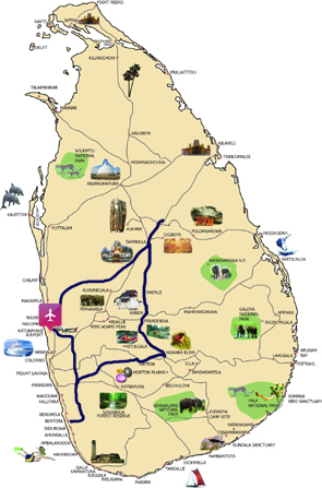
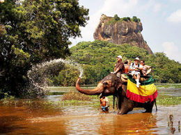
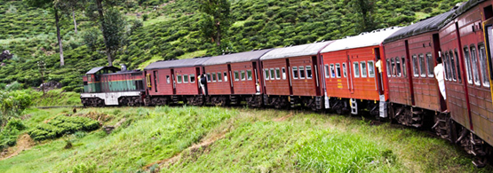
Habarana
This small town serves as a base for Sigiriya and safaris to Minneriya and Kaudulla
National Parks. There's a fast-expanding range of accommodation in the surrounding
area including lots of new luxury places. Transport links are excellent: Habarana
has the nearest train station to both Dambulla and Sigiriya and sits on a busy
crossroads.
Elephant rides around the tank can be arranged for a pricey US$20 to US$30 per
person per hour. In the creek near town you can watch mahouts scrubbing down their
elephants; guides and most locals can point the way.
Kandy
Kandy is a major city in Sri Lanka, located in the Central Province, Sri Lanka. It
is the second largest city in the country after Colombo. It was the last capital of
the ancient kings' era of Sri Lanka. The city lies in the midst of hills in the
Kandy plateau, which crosses an area of tropical plantations, mainly tea. Kandy is
both an administrative and religious city and is also the capital of the Central
Province. Kandy is the home of The Temple of the Tooth Relic (Sri Dalada Maligawa),
one of the most sacred places of worship in the Buddhist world. It was declared a
world heritage site by UNESCO in 1988.
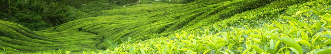
Nuwara Eliya
Nuwara Eliya is a city, in the hill country of the Central Province, Sri Lanka. The
city name meaning is "city on the plain (table land)" or "city of light". The city
is the administrative capital of Nuwara Eliya District, with a picturesque landscape
and temperate climate. It is located at an altitude of 1,868 m (6,128 ft) and is
considered to be the most important location for Tea production in Sri Lanka. The
city is overlooked by Pidurutalagala, the tallest mountain in Sri Lanka.
The city was founded by Samuel Baker, the discoverer of Lake Albert and the explorer
of the Nile in 1846. Nuwara Eliya's climate lent itself to becoming the prime
sanctuary of the British civil servants and planters in Ceylon. Nuwara Eliya, called
Little England then, was also a hill country retreat where the British colonialists
could immerse in their pastimes such as fox hunting, deer hunting, elephant hunting,
polo, golf and cricket.
Bentota
Bentota is a coastal town in Sri Lanka, located in the Galle District of the
Southern Province, governed by an Urban Council. It is approximately 65 kilometres
(40 mi) south of Colombo and 56 kilometres (35 mi) north of Galle. Bentota is
situated on the southern bank of the Bentota River mouth, at an elevation of 3
metres (9.8 ft) above the sea level. The name of the town is derived from a mythical
story which claims a demon named 'Bem' ruled the tota or river bank.

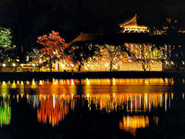
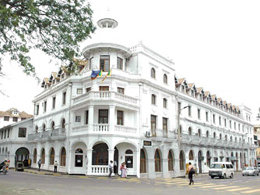
Colombo
Colombo is the commercial capital and largest city of Sri Lanka, with a population
of 5.36 million metropolitan area, [dubious – discuss] with 555,031 in the city
limits, and a popular tourist destination. It is located on the west coast of the
island and adjacent to Sri Jayawardenepura Kotte, the legislative capital of Sri
Lanka. Colombo is often referred to as the capital since Sri Jayawardenapura Kotte
is within the urban area of, and a satellite city of, Colombo. It is also the
administrative capital of Western Province, Sri Lanka and the district capital of
Colombo District. Colombo is a busy and vibrant place with a mixture of modern life
and colonial buildings and ruins. It was the legislative capital of Sri Lanka until
1982.
Due to its large harbour and its strategic position along the East-West sea trade
routes, Colombo was known to ancient traders 2,000 years ago. It was made the
capital of the island when Sri Lanka was ceded to the British Empire in 1815, and
its status as capital was retained when the nation became independent in 1948. In
1978, when administrative functions were moved to Sri Jayawardenepura Kotte, Colombo
was designated as the commercial capital of Sri Lanka.